
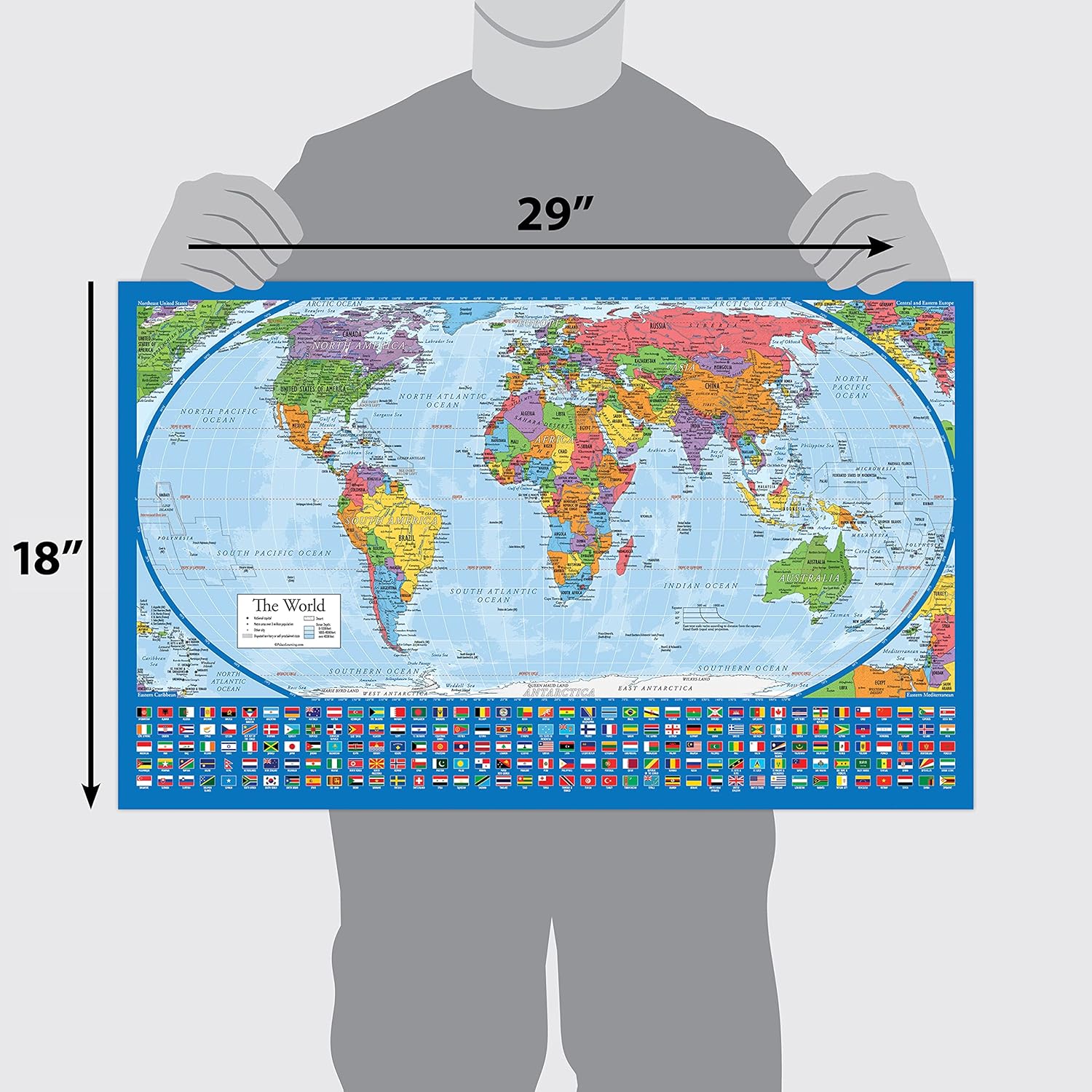
Equal Earth World Map Poster – map design shows continents at true relative size. (LAMINATED, 18” x 29”)
$9.97
Related Products


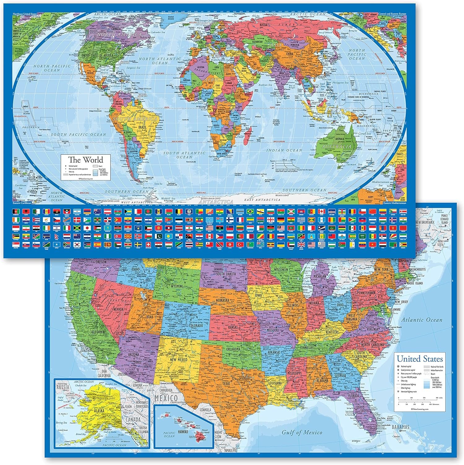


Product description

Features of the Posters

Durable Heavy Duty Lamination
This poster is protected by heavy duty lamination which protects it from rips and stains.

Standard Size
The posters are 18″ x 29″ and can be hung with or without a frame. If framing, it fits a size 18″ x 29″ frame.

Waterproof Edge Seal
Double sided lamination and waterproof edge seal make it spill and mess-proof.


18” x 29” in size
Heavy duty lamination for added durability
Tear Resistant
13 reviews for Equal Earth World Map Poster – map design shows continents at true relative size. (LAMINATED, 18” x 29”)
Add a review
$9.97
L J –
Beautiful sturdy map
Very nice map, it’s been framed for display. I love the tan antique look, on the reverse side there’s an identical map in color great color block for children to identify locations. The map is laminated and sturdy. Great size for wall display. This map looks beautiful.
Rik Soto –
Nice addition to a study.
Really like having a map that reflects relative size of countries, land masses. Let’s agree to retire the Mercator proj.Muted color scheme on one side, my preference, and bold colors on the reverse.
Angela McCrary –
Complete with Bonus flags
Loved this map. it is laminated, and two sided. The flags at the bottom were a nice touch. Well worth the money!
caroll e. –
New Perspective on Earth
Very interesting new perspective on the Earth’s continents. I lured the two sides of the map – one showed thecountries and the back was a political map. Probably due to limitations, the far north Arctic area and the far south area is not well defined. Very sturdy plastic coated and hints to lay the rolled up map flat.
Kimba –
REAL Hard to find, TRUE TO SIZE World MAP – everything I wanted and more!
Yes yes and yes! I was looking for a map that dispels the falsehood of Africa being much smaller than most continents like the Mercator map shows. This map is more true to size amazing price and you get a surprise on both sides. Includes the flags of most countries, laminated and is perfect for display. My boyfriend and I have matching maps, mounted each, and use push pins to display where we’ve traveled.
Ger –
A size accurate map at last!!
This map actually has the correct proportional size of each country! Not like most maps which distorsione the size of countries based in old prejudices. So great to get in front of young learners- two sides. The colors are vibrant. Laminate allows for easy use on the deal or on the wall.
Meghan Ganstine –
Map
We love it!
john a wilson –
I cannot flatten the map out to read.
The map itself is fine. The plastic that it is inclosed in is so thick that I doubt I will be able to get it flat. It is difficult to read. It came rolled up inside a small tube.
Romain Ludovicy –
Good quality item
Stuart Benson –
ExcellentBetter than I expected
Driane –
Clear printing with everything nicely identified
I Gendron –
Parfait pour l’étude de mes enfants. De plus, avec les drapeaux des pays c’est comme si c’est un 2 pour 1La carte peut être utilisée recto verso
DuBartas –
It’s good to see countries mapped using better relative sizes.