
Updated Peters Projection World Map | Laminated 36″ x 24” Map | Developed by Arno Peters | Most Proportionally-Accurate Land Mass Depiction | Country Size & Scale is True, Unlike Most Maps | Major Countries, Cities, & Bodies of Water Labeled
$34.99
Related Products


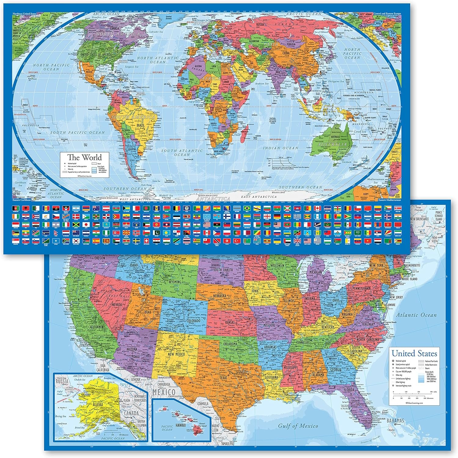


Discover an updated and accurate representation of the world with this laminated Peters Projection World Map, measuring 36 x 24 inches. Our map offers true-to-scale country sizes, providing a less biased perspective compared to other maps. It features labeling of major countries, cities, and bodies of water, ensuring up-to-date and detailed information. This world map is not only educational but also aesthetically pleasing, with a multi-colored design that groups continents by color family. The laminated finish adds durability, making it waterproof, fade-resistant, and dry-erasable. Proudly furnished by a family-owned small business in Charlotte, NC, this product is perfect for schools, businesses, or personal use.
ONLY UPDATED PETERS PROJECTION WORLD MAP – Unlike other out-of-date Peters Projection style maps, our Updated Peters World Map not only presents the continents in their true proportion to one another but it also has the most accurate labeling of Countries, Cities and Bodies of Water you can find.
CULTURALLY EQUITABLE WORLD MAP – This post-colonial map of the world has become the prefered map of UNESCO, aid agencies, schools and businesses. The Peters Projection Map depicts all countries’ land area accuratelywhen compared to each other, resulting in a less culturally / politically biased map.
LAMINATED WORLD MAP – 36” X 24” rectangular unfolded World Map. Printed with high-quality inks and finished with a 1.7 mil satin-finish lamination on both sides. This laminated version of our up-to-date Peters Projection World map is waterproof, fade resistant, and dry-erasable. It arrives rolled (not folded) in a protective tube.
AESTHETIC AND EDUCATIONAL – This World Map comes in a multi-colored design that groups countries in each continent within the same color family, but varies the shades of color between countries for easy delineation and identification. The result is a beautiful map that is tastefully colorful as well as educational.
SUPPORT SMALL BUSINESS. Furnished by a family-owned small business in Charlotte, NC.
8 reviews for Updated Peters Projection World Map | Laminated 36″ x 24” Map | Developed by Arno Peters | Most Proportionally-Accurate Land Mass Depiction | Country Size & Scale is True, Unlike Most Maps | Major Countries, Cities, & Bodies of Water Labeled
Add a review
$34.99
Carol L. Backert –
perfect size for my wall
Good quality great print easy to read makes it perfect for me and my husband both in our late 70’s
C. Branham –
Exelent map
Beautiful, clear, accurate, sturdy.
Amazon Customer –
Updating with this 2021 map was worth it
For several years I enjoyed my prior somewhat larger version of the Peter’s projected map that was also printed in various colors & laminated. This updated map occupies the same area where I enjoyed my prior reference. A smart looking map like no other on the market. I would fully encourage those in need of a up-to-date (2021) wall map to take notice of and would like to purchase, well worth the investment. Good stuff.
J Diamond –
Love this Map
If you like Maps this is the one you want. It shows the true size country to country. comparison. It’s certainly educational and quite interesting to see. The color and the printing were perfect. I wouldn’t change anything.
G1 –
🌍The world must know! ✊🏾
***My students from the African diaspora have become inspired and emotionally moved after seeing this map in my office. The future generation will KNOW THE TRUTH!!!!
Butch Blawd –
Global flat map.
Durable & good visual quality.
RKR –
Just as advertised and well-made
This map is excellent; it depicts countries and continents true to actual/relative size. Very interesting and illuminating. It is very well-made, arrived promptly, and was easy to unroll and mount.
J. Longenecker –
areas accurate, shapes distorted
The Peters Projection accurately shows the relative size of different countries (who knew south american countries were so big!) The cost of this accuracy is that equatorial countries are severely squashed horizontally, while polar countries are squashed vertically. If you live in one of these countries, you might find it unpleasant to look at the deformed shape of your motherland, like looking at your face in a funhouse mirror.Since very few of us will use this map to navigate on the high seas, there is no need to religiously keep the meridians parallel.The classic schoolroom world map is still the best, either the version with curved edges or the version with gaps in the oceans in order to spread the globe out flat. The Mercator is inexcusable, yet it continues to dominate image searches of world maps.